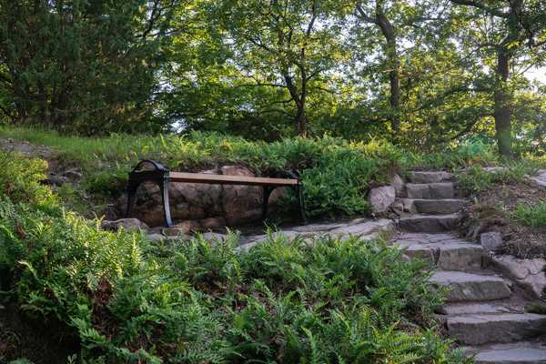
Whether you're visiting Sweden's wind-swept south or its Arctic north, Sweden's top hiking trails make for a great way to explore the country and see all its many sides –from enchanting forests and idyllic countryside to historic ruins and enticing waters. Discover glorious rape fields on the Österlen Trail in the south or hike along snow-capped mountain tops in northern Lapland. Pitch up your tent, book yourself into a cosy cabin or plan your adventure so that you'll have a warm bed to crawl into at the end of each strenuous yet exciting and invigorating day. Discover Sweden's history with a hike over grave fields or through beautiful old industrial areas. Book a guided tour and combine your hike with an exciting kayak adventure. Or why not opt for a more relaxing, all-inclusive experience complete with luggage transport so you can forget the logistics and simply focus on enjoying nature?
- 1
King's Trail (Kungsleden)
See gorgeous mountains along one of Sweden's most popular hiking routes

- Seikkailu
- Halpa
- Valokuvaus
The King's Trail (Kungsleden) offers 273 miles of hiking through Lapland's magnificent mountain landscape. It starts at the ski resort town of Hemavan in the region of Västerbotten and takes you north to the small village of Abisko, which is a popular outdoor destination for tourists from all over the world. You can begin your adventure at any point of the trail you like, but if you plan on arriving by car then one of the easiest places to embark from is Hemavan. You also have the option to fly straight to Hemavan Tärnaby Airport. Alternatively, you can begin in Abisko which is connected to the larger town of Kiruna by train.
If you don't feel like lugging around lots of food and heavy equipment, plan your journey so that you can stay overnight in the mountain cabins run by the Swedish Tourist Association (STF). Many want to see the mountains when they are in bloom, but remember that Lapland is also magical in its firey red autumn garb, and there is better availability at the cabins then, too.
Kartta - 2
Mount Kebnekaise
Sweden's tallest mountain offers lovely hiking even for unseasoned trekkers

- Seikkailu
- Halpa
- Valokuvaus
Kebnekaise may be the tallest peak in Sweden, but don't let that designation put you off – the mountain offers picturesque routes which are suitable even for the inexperienced. Kebnekaise is located close to the northern Swedish mining town of Kiruna in the Arctic region of Norrbotten. The closest settlement to the foot of the mountain is Nikkaluokta which takes 90 minutes to reach from Kiruna by bus. If you don't quite feel up to the feat of conquering the summit alone, you can sign up to a guided tour in the summer which will take you up the Eastern Route. Just be sure to wrap up well as the southern peak is the only one in Sweden to be capped by a glacier.
More experienced mountaineers who want to scale the mountain in the winter are better off taking the Western Route over Vierramvare as this gentler incline requires less climbing.
Osoite: 981 99 Kiruna, Sweden
Kartta - 3
Sörmlandsleden Trail
Hike through dark forests and historic countryside

- Seikkailu
- Halpa
- Valokuvaus
The Sörmlandsleden Trail offers 620 miles of glistening lakes, deep forests and historic countryside. The first stage begins in the Nackareservatet Nature Reserve in a southern suburb of Stockholm by the name of Söderort. The trail head is connected to central Stockholm by metro, making it fairly easy to each.
Where exactly the route ends is something of a mystery as you can either take a circular trail that returns you to Söderort or veer off onto an offshoot. It's up to you whether you want to go for a day-hike or challenge yourself to conquer the entire stretch. Just be careful where you set your feet on the mossy rocks, or opt for an easier walk around some of the area's palaces and farmyards. Hiking with kids? Be sure to combine your adventure with a spot of camping and a visit to the Kolmården Wildlife Park (Kolmårdens Djurpark).
KarttaValokuva: Stockholm Country Break (CC BY 2.0) muokattu
- 4
St. Olav's Path (St. Olavsleden)
Go on a pilgrimage through Sweden and Norway

- Seikkailu
- Halpa
- Valokuvaus
The St. Olav's Path (St. Olavsleden) takes you along a beautiful landscape, past valleys and lakes, over mountains and along fjords before delivering you to the Norwegian city of Trondheim. The trail begins at the small village of Selånger just outside Sundsvall and ends at the Nidaros Cathedral in Trondheim, Norway. The easiest way to reach Selånger is to take the car and set Selånger Church (Selånger Kyrka) as the destination in your GPS. Buses also stop at Selångergården which is just over half a mile from the church.
The almost 400 mile long pilgrimage trail takes you along the very same route that Olav II of Norway is said to have followed on his journey to Christianise Norway and retake its throne. You will have the chance to drink from holy sources and amble through quaint villages where you can rest your feet before magnificent views. The mostly flat trail is also suitable for traversing by bike.
Kartta - 5
The Emigrant Trail (Utvandrarleden)
Follow in the footsteps of Swedish emigrants through gorgeous nature

- Seikkailu
- Halpa
- Valokuvaus
The Emigrant Trail (Utvandrarleden) will take you through dark forests, past shimmering lakes, and alongside moss-covered stone walls and red-painted farmyards. This historic route once taken by world-weary emigrants as they set off for the New World is without a doubt one of the top hiking trails in Sweden.
The 68 mile trail forms a large loop through the municipalities of Emmaboda, Lessebo and Tingsryd in the southern part of the Småland region. It is usually easiest to arrive by car no matter where you decide to start from, although Emmaboda is also connected to the cities of Kalmar and Växjö by train. For a more comfortable expedition, book an all-inclusive tour package by foot or by bicycle along the route that the emigrants left behind. You can also book a luggage transportation service, leaving you completely free to focus on your adventure.
Kartta - 6
Skåneleden Trail
Cross Scania in a month or take a shorter stroll along the beach

- Seikkailu
- Halpa
- Valokuvaus
The Skåneleden Trail offers everything from golden fields of rape to mystical and historic woodlands along a whopping 770 miles through much of Sweden's southernmost region. The trail begins in the town of Trelleborg on the south coast and ends at Laholm Bay in the north of the region. There are many different routes, though, so you can choose for yourself exactly which path to take — east coast to west cost, north to south, or a loop of the gorgeous Österlen region.
Most parts of the trail are easy to reach by car. Discover everything from tranquil bays and fishing spots to stately palaces, farmyards, caves and forests. If you like the idea of combining your hike with a spot of art and culture, then time your visit to coincide with the Konstrundan art event which is held in the spring each year, when local artists open their studios and workshops to visitors.
Kartta - 7
High Coast Trail (Höga Kustenleden)
Enjoy impressive mountains and inviting waters

- Seikkailu
- Halpa
- Valokuvaus
The High Coast Trail (Höga Kustenleden) takes you through deep forests and along craggy coastlines, with sections to satisfy seasoned and inexperienced hikers alike. The 80 mile trail goes through the historic landscape of Ångermanland, stretching from Hornö to Varvsberget in central Örnsköldsvik. The southernmost part of the trail can be reached by bus while the northernmost part is serviced by train.
You'll find no shortage of magnificent views as you make your way along the trail. Be sure to keep your camera on hand as you hike along Slåtterdalsskrevan, which is a narrow but deep ravine and a true marvel to behold. You may also want to pack your swimmers if visiting in the summer as the archipelago is brimming with great spots to take a dip.
Kartta - 8
Signaturled Tiveden Trail
Conquer boulder ridges and hike through ancient forests

- Seikkailu
- Halpa
- Valokuvaus
The Signaturled Tiveden Trail takes you right through historical sights, along lakes, over rocks and through enchanting woodlands. It is located in a central region of Sweden to the north-west of one of the country's largest lakes, Lake Vättern, and stretches from a camping area called Stenkällegården to the ruins of an old monastery. The easiest way to reach the various different starting points is by car although there is also a bus stop at Bodane, which is just a few hundred metres from the most northerly point of the trail.
The largest part of the almost 31 mile-long trail takes you through Tiveden National Park, where you'll get to climb over boulder ridges and stroll through enchanted woodlands. What's more, for parts of the trail you will be following an old path once used by monks to the ruins of their monastery. If you're visiting in the summer, be sure to pack your swimming gear and enjoy a revitalising dip in one of the many lakes you'll pass along your way.
Kartta - 9
Roslagsleden Trail
Discover gorgeous nature and exciting history by foot

- Seikkailu
- Halpa
- Valokuvaus
The Roslagsleden Trail takes you along 118 miles of leafy woodland, historic sights, picturesque coastlines and a living pastoral landscape. The trail begins at Danderyd Church in Stockholm and finishes at the Albert Engelström Museum just outside the city of Norrtälje, which is located to the north of the capital. Both the most northerly and southerly points of the trail are located just a few hundred metres away from a bus stop, making the route accessible even without a car.
As you follow one of the top hiking trails in Sweden, you will pass fascinating rock carvings, idyllic landscapes and an ancient smithy. TMake the most of the chance to swim in Lake Gunnsjön or stop at the Domarudden Nature Reserve for a barbecue after a nice walk through its leafy woodland.
KarttaValokuva: Udo Schröter (CC BY-SA 3.0) muokattu


